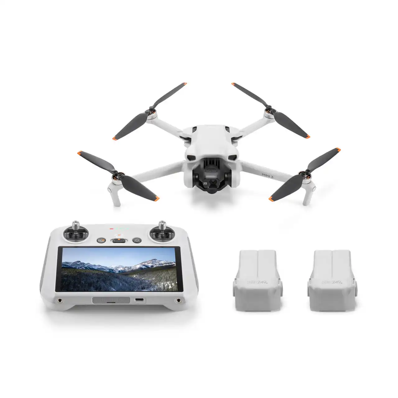
Drones
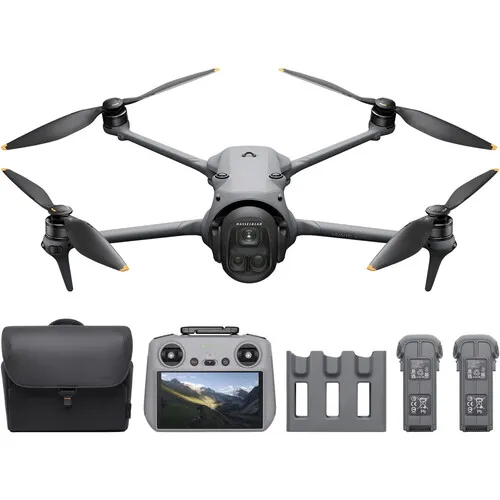
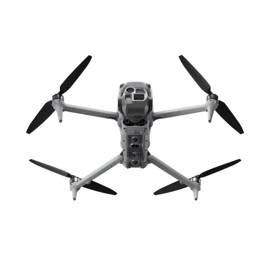
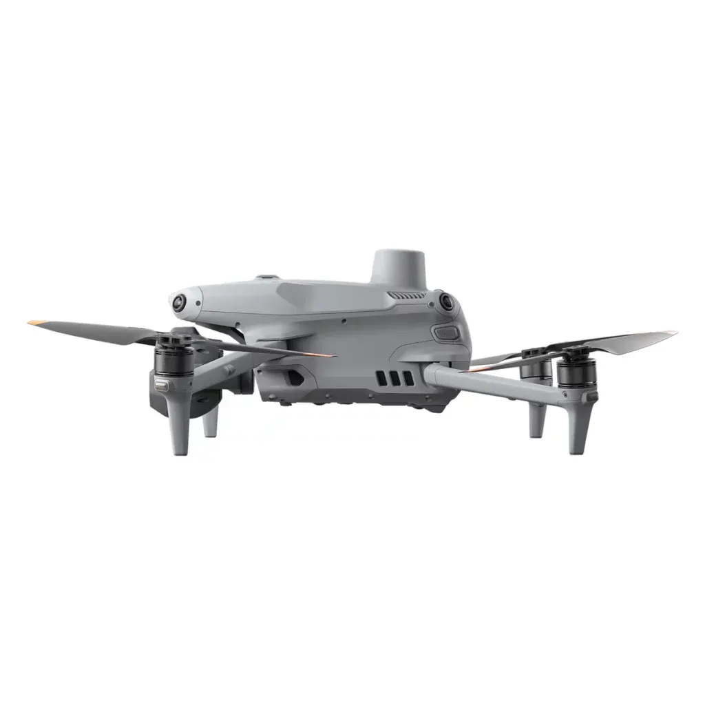
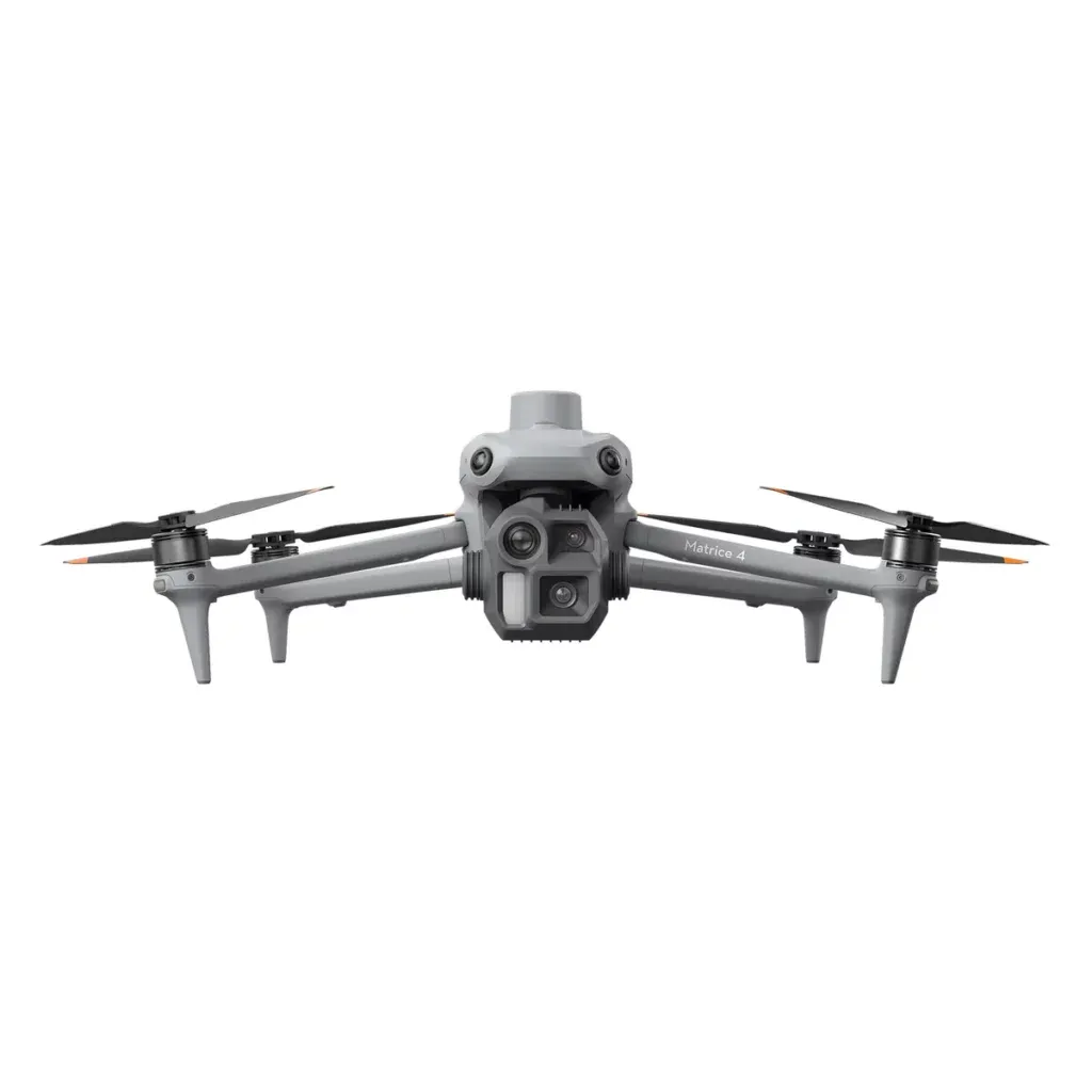
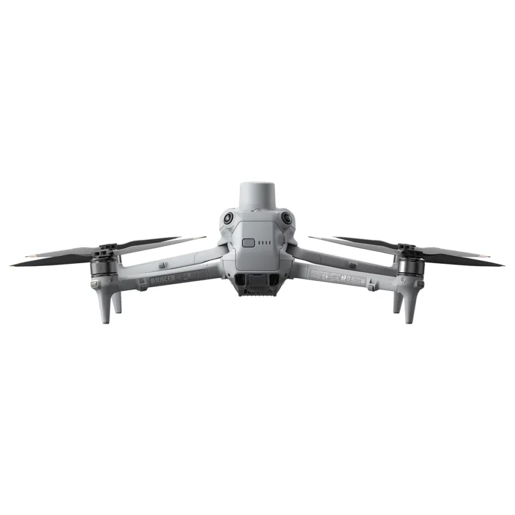
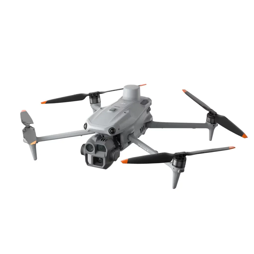
DJI Matrice 4E
Tk 860,000
Tk 1,000,000
-14%
• Rapid takeoff within 15s
• 25 km max transmission range
• Supporting D-RTK 3 Relay station
• Low-Light Fisheye Omnidirectional Sensing
• 25 km max transmission range
• Supporting D-RTK 3 Relay station
• Low-Light Fisheye Omnidirectional Sensing
📋 Detailed Description
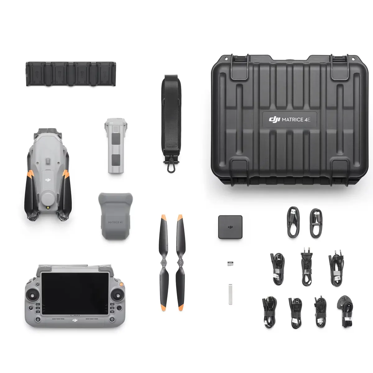
DJI Matrice 4E Enterprise DroneThe DJI Matrice 4E Enterprise Drone is a high-performance UAV engineered for precision mapping, surveying, and industrial inspection. Equipped with a 4/3" CMOS 20MP wide-angle camera and mechanical shutter, it delivers exceptional image clarity and supports mapping without ground control points (GCPs). Its Smart 3D Capture feature enables rapid modeling and route planning directly from the remote controller, streamlining workflows for complex structures. With a maximum flight speed of 21 m/s and up to 49 minutes of flight time, the Matrice 4E ensures efficient coverage over large areas. RTK-enabled positioning systems—GPS, Galileo, BeiDou, and GLONASS offer centimeter-level accuracy for critical operations. The drone’s omnidirectional obstacle avoidance and 12 m/s wind resistance enhance safety in dynamic environments. Ideal for enterprise users, the DJI Matrice 4E combines intelligent automation, robust imaging, and long-range capability to redefine aerial data collection and geospatial analysis.Flight Performance and Operational EfficiencyBuilt for endurance and speed, the DJI Matrice 4E offers up to 49 minutes of flight time and a top speed of 21 m/s. It supports RTK positioning with GPS, Galileo, BeiDou, and GLONASS for centimeter-level accuracy. The drone’s 12 m/s wind resistance and omnidirectional obstacle avoidance ensure safe operation in complex environments. Whether surveying large areas or navigating tight industrial zones, the DJI Matrice 4E adapts with ease. Its intelligent automation and long-range capabilities make it ideal for enterprise users in industries like energy, mining, and public safety, where efficiency and reliability are key.Advanced Imaging and Mapping PrecisionThe DJI Matrice 4E Industrial Drone is designed for professionals who need high-accuracy aerial data. It features a 4/3" CMOS 20MP wide-angle camera with a mechanical shutter, capturing sharp, distortion-free images ideal for mapping and surveying. With Smart 3D Capture, users can generate models and plan routes directly from the controller, eliminating the need for time-consuming post-processing. The DJI Matrice 4E Commercial drone supports mapping without ground control points (GCPs), making it perfect for construction, agriculture, and environmental monitoring. Its imaging capabilities and intelligent workflow tools make it a reliable choice for fast, precise data collection in demanding field conditions.Buy DJI Matrice 4E Enterprise Drone from the Star TechIn Bangladesh, you can get original DJI Matrice 4E Enterprise Drone From Star Tech. We have a large collection of latest DJI Drone to purchase. Order Online Or Visit your Nearest Star Tech Shop to get yours at lowest price. The DJI Matrice 4E Enterprise Drone comes with 12 months warranty.NB: For warranty claims from Bangladesh to Hong Kong, the customer must bear one side of the courier cost.Restrictions:To fly Drone, you may need to get Government Authorized Certificate for your area or any other place. Star Tech will not provide a refund or be involved in any other actions regarding Drone Flying Restrictions.For a Drone purchase, you need to submit your national identity card or passport copy and valid mobile number (which is registered with the same national identity card) to our sales center or via mail.
=== Specifications ===
Aircraft
Weight (Battery & Propellers Included): Standard Propellers: 1420 g
Low-Noise Propellers: 1430 g
Diagonal Size (Propellers Excluded): Folded: 260.6×113.7×138.4 mm (L×W×H)
Unfolded: 307.0×387.5×149.5 mm (L×W×H)
Max Ascent Speed: 10 m/s
Max Descent Speed: 8 m/s
Max Speed: 6 m/s
Max Tilt Angle: 35°
Max Service Ceiling Above Sea Level: 21 m/s
Max Wind Speed Resistance: 12 m/s*
Max Flight Time: 49 min (standard propellers)
46 min (low-noise propellers)
Operating Temperature Range: -10℃ to 40℃ (14°F to 104°F)
Satellite Positioning Systems: GPS + Galileo + BeiDou + GLONASS*
Hover Accuracy Range: 42 min (standard propellers)
39 min (low-noise propellers)
Gimbal
Stabilization: 3-axis (tilt, roll, pan)
Controllable Range: Tilt: -90° to 35°
Max Controllable Angular Speed: 100°/s
Angular Vibration Range: Gimbal Mechanical Limits:
Tilt: -140° to 50°
Roll: -52° to 52°
Pan: -65° to 65°
Soft Limits:
Tilt: -90° to 35°
Roll: -47° to 47°
Pan: -60° to 60°
Others: Angular Vibration Range-±0.007°
Infrared Sensing System
Obstacle Sensory Range: Binocular Measurement Range: 0.4-22.5 m
Measurement Range: 0.4-200 m
Obstacle Avoidance Speed: Flight Speed ≤21 m/s
Measurement Range: 0.3-18.8 m
Obstacle Avoidance Speed: Flight Speed ≤10 m/s
The FOV to the front and rear is 160° and 160° to the right and left.
Measurement Range: 0.4-22.5 m
Measurement Range: 0.4-200 m
Obstacle Avoidance Speed: Flight Speed ≤21 m/sField of View (FOV)-90° (horizontal), 135° (vertical)
Measurement Range: 0.5-32 m
Measurement Range: 0.5-200 m
Obstacle Avoidance Speed: Flight Speed ≤21 m/s
FOV: 90° (horizontal), 90° (ver...